 |
|||||||||||
|
|
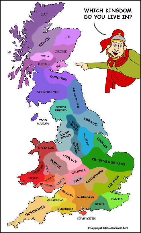
Putting them on the Map! Here's a map of the British & Pictish kingdoms that were around in the Dark Ages. They were ruled by local kings. We don't know the names of some of the kingdoms; So some of those on the map are guesses. We don't know exactly where the borders were either. The map gives you a rough idea though. They changed a lot over time too. The green ones were quickly taken over by the Saxons.
These are mostly British kingdoms, but the purple ones at the top are Pictish. Sorry, we couldn't fit the Outer Hebrides, Orkneys or Shetlands on the map, but they probably each had their own king.
|
||||||||||
| © Nash Ford Publishing 2003. All Rights Reserved. | |||||||||||